Services
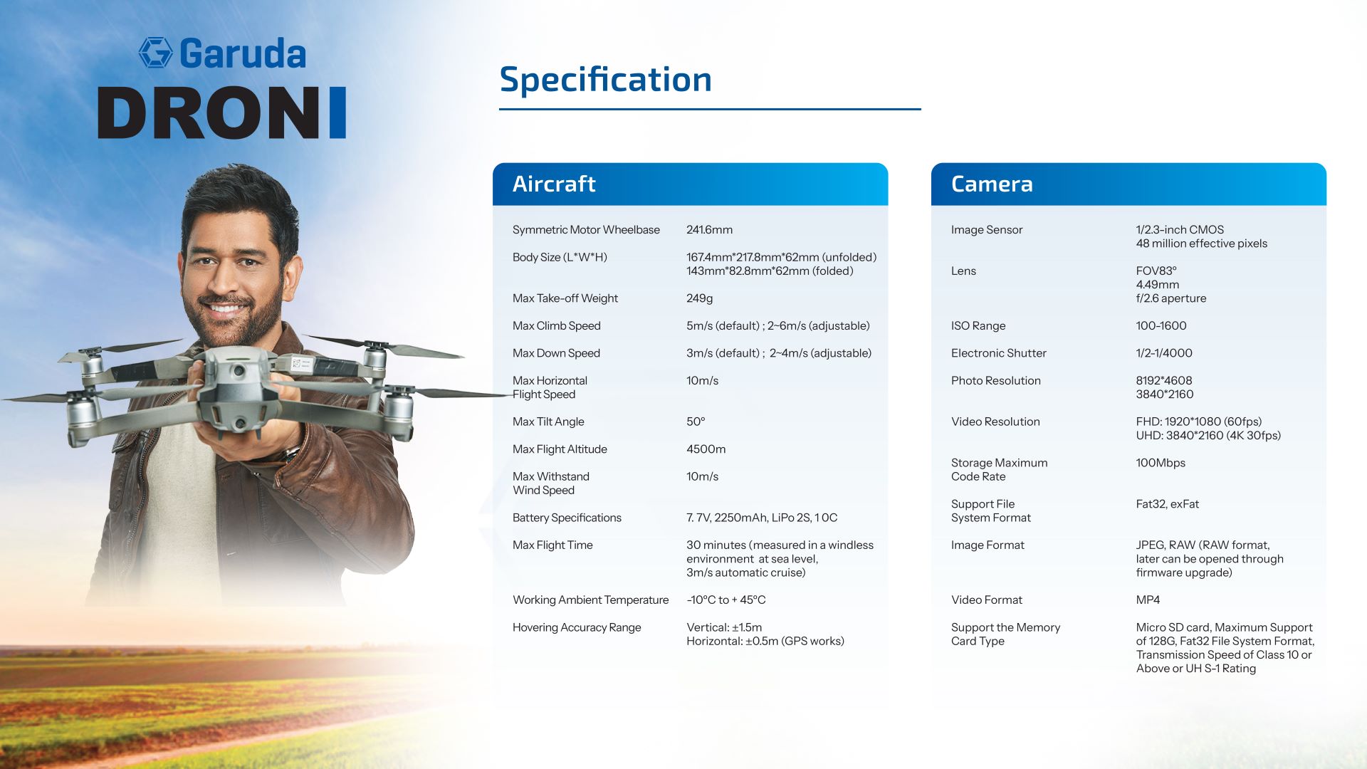
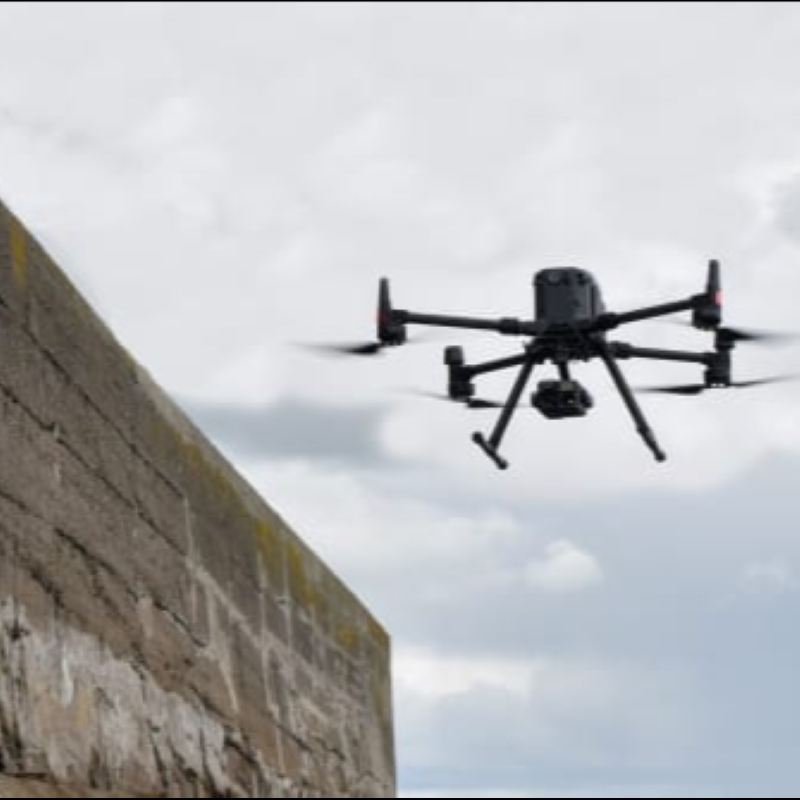
Our company offers a comprehensive suite of industrial services, including drone-based thermal imaging, ultrasonic thickness testing, and inventory management, tailored for Industry 4.0 upgrades. With extensive experience, we’ve earned credibility, securing expedited approvals from DGCA and MOCA. Collaborations with leading R&D entities like IIT Kanpur and MIT bolster our capabilities. Explore our construction drone services and UAV industrial inspection for tailored industrial solutions. Find the ideal industrial drone considering factors like price, monitoring features, and camera specifications.
Agriculture
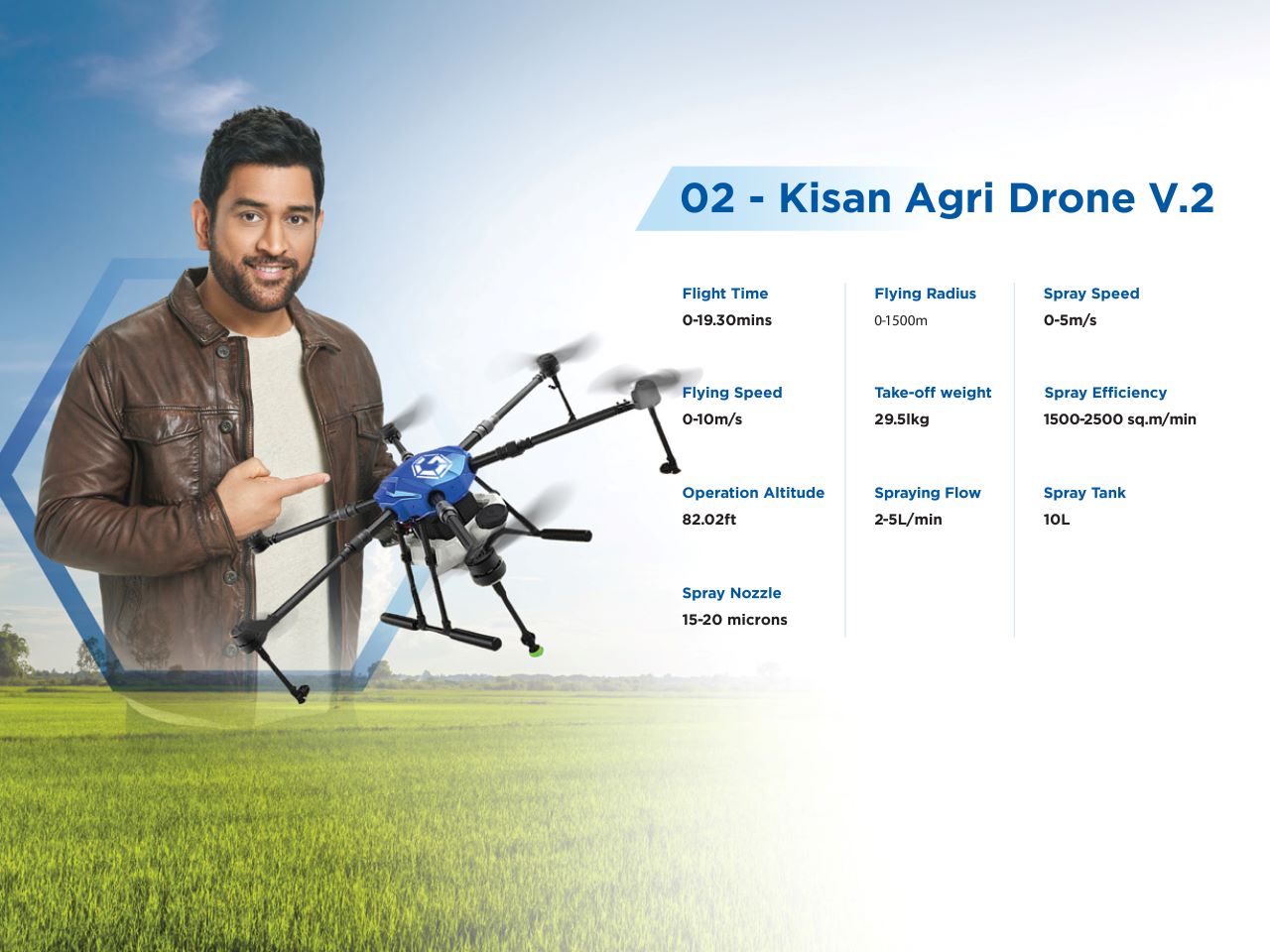
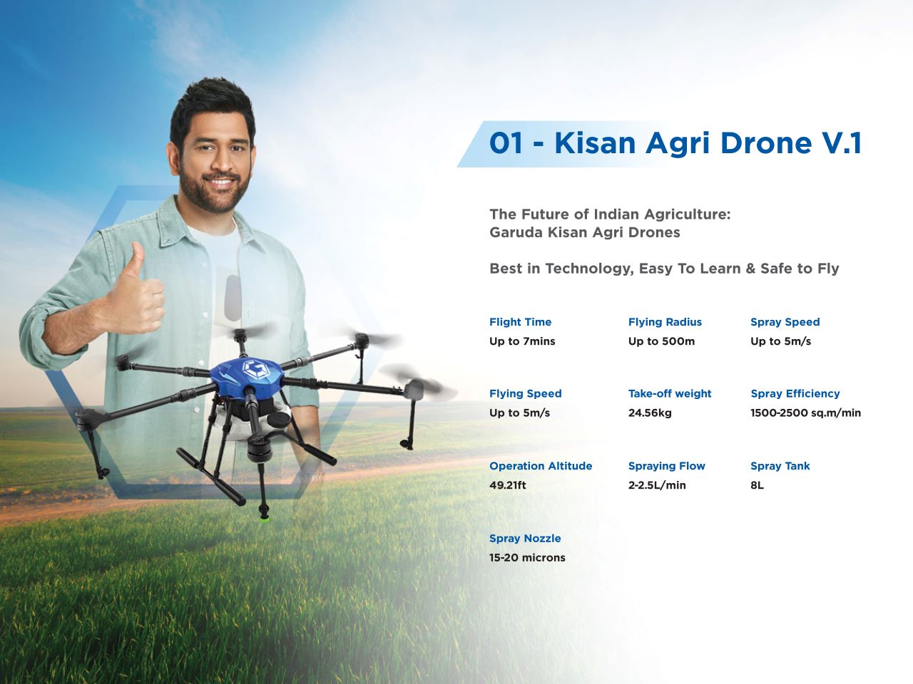
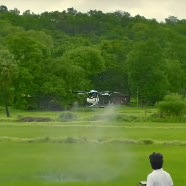
Agricultural drones equipped with advanced technology such as field soil analysis, crop scouting, and precision farming solutions enable farmers to make informed decisions and adapt to diverse conditions. These drones play a crucial role in crop health assessment, treatment, irrigation management, and damage evaluation. By leveraging the capabilities of agricultural drone technology, farmers can enhance crop yields while reducing time and costs. Garuda’s agricultural drones, with their precision farming solutions and digital imaging capabilities, provide accurate data for optimizing agricultural operations and monitoring crop growth. The use of these drones not only increases efficiency but also ensures crop safety and enables timely actions to improve overall agricultural productivity.
Disaster Management
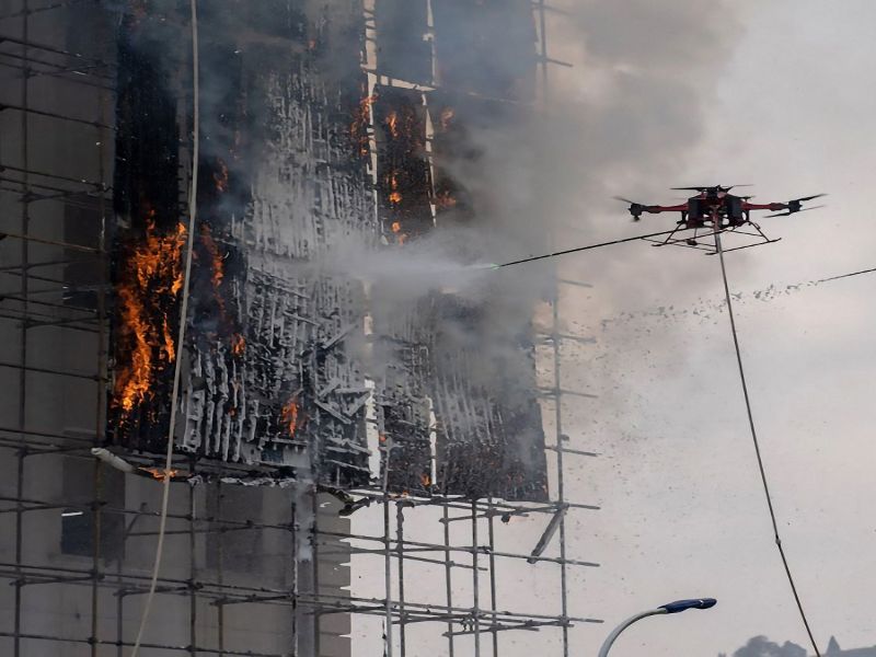
Drone technology plays a crucial role in disaster management by offering emergency drone services for real-time disaster assessment and mapping of disaster zones. Disaster management drones can swiftly locate safe areas for victims and aid in inspecting and modeling the extent of damage during disasters such as earthquakes. This technology enables prompt recovery strategies, insurance estimates, and aids in the search and rescue operations of individuals stranded in remote areas. UAVs have significantly advanced in crisis response, providing cost-effective solutions and faster reaction times compared to traditional methods.
Anti-Drone System
The firm specializing in Unmanned Aerial Vehicles recently introduced an Anti-drone system in collaboration with the Defence Research and Development Organisation. This Drone defense technology incorporates a specialized five-layered design capable of capturing other drones. It employs various techniques for Drone detection and neutralization to counter foreign enemy drones effectively. The system includes subsystems like Electromagnetic interference systems, laser neutralization systems, Gun defense systems, and Mesh ejection systems, all of which are part of Anti-UAV systems. Additionally, there are subsystems within the Radar detecting system, contributing to the overall efficiency of Unmanned aerial vehicle defense. These systems, equipped with 100 percent accurate components, ensure precise neutralization of any threatening UAV, making it a highly reliable and unpredictable defense technology.
Delivery / Load Carrying
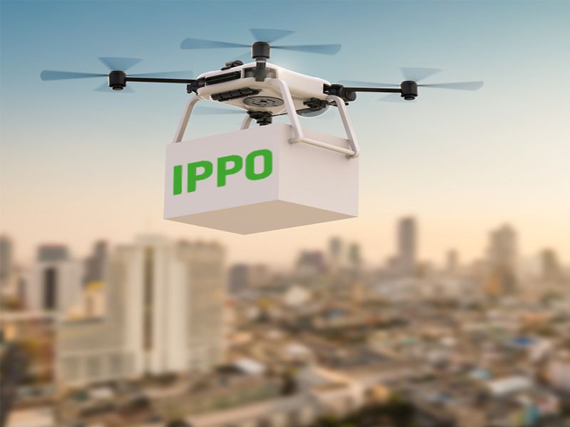
Load-carrying UAVs can be deployed as emergency supply drones in calamitous situations. In instances where disaster strikes and disrupts infrastructure supply lines, these drones serve as critical components of disaster relief logistics. By utilizing drone delivery services, rescue personnel can efficiently transport supplies, bolster infrastructure support, and establish communication networks, ultimately mitigating suffering and preventing further damage. The advantages include minimized transportation times, reduced traffic congestion, enhanced safety due to decreased vehicle miles traveled and fewer at-grade rail crossings, lower greenhouse gas emissions, and increased route flexibility.
Warehouse Management
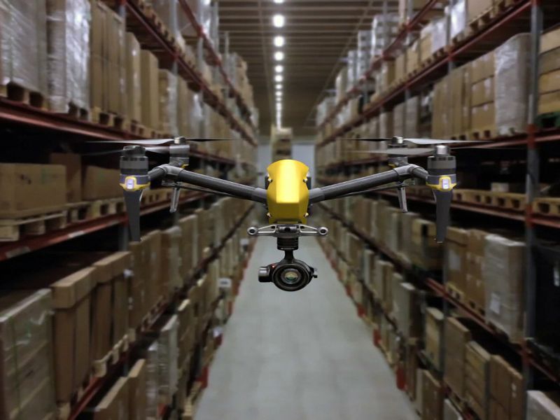
We leverage advanced software with reliable load-carrying UAVs to automate drone-based inventory counts in warehouses, distribution centers, and retail locations such as warehouse clubs, providing a safe and cost-effective warehouse drone solution. Our drones offer a fast and scalable approach to inventory management, seamlessly integrating with warehouse management systems and accommodating various storage forms, barcodes, QR codes, and inventory counting methods. Through multi-sensor fusion, computer vision, and machine learning techniques, our drone-based inventory counts operate with precision even in GPS-denied conditions. This technology enables faster inventory management, tackles tasks hazardous to humans, and delivers high accuracy in tracking inventory and monitoring stock levels 24/7, reducing errors and associated costs significantly.
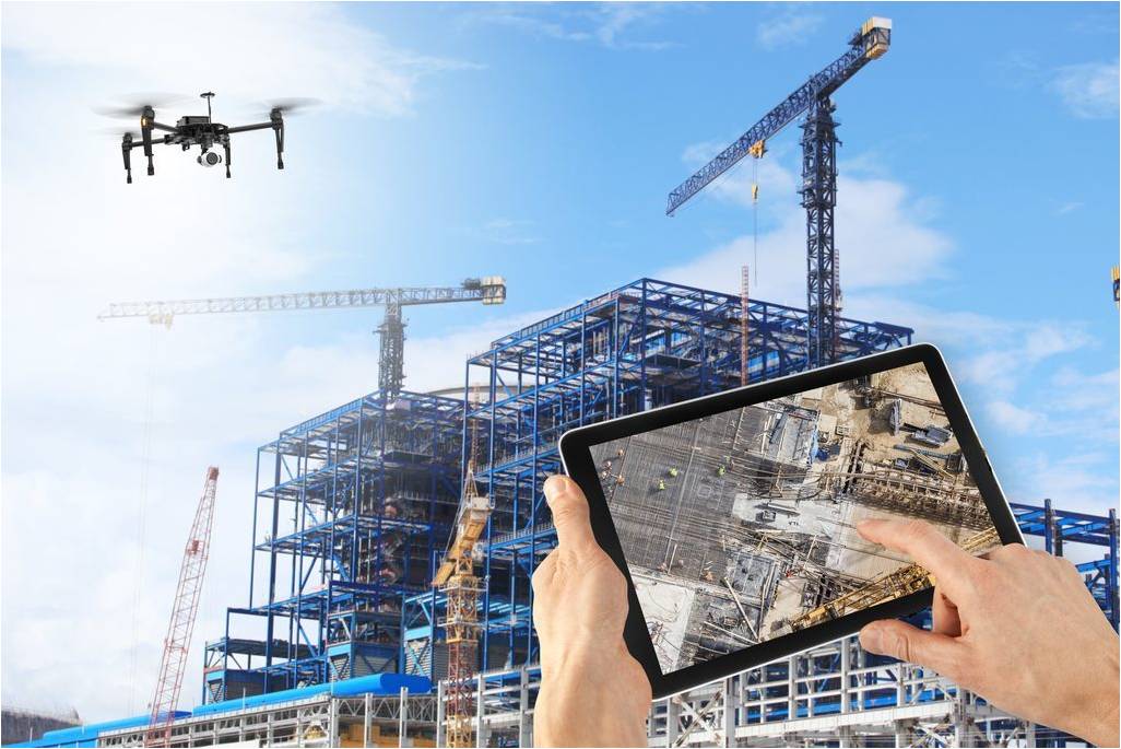
Project Management & Structural Inspection
Using drone footage for project management streamlines communication by providing visual updates to stakeholders unable to attend physically. This includes investors, clients, and other parties, easing their concerns and enabling them to monitor progress visually. Additionally, drones aid project managers in directing teams efficiently by capturing areas needing attention, facilitating targeted instructions for on-site workers. By utilizing drones for structural inspection, projects benefit from cost-effective monitoring, enabling frequent progress checks and accurate timeframe calculations. Real-time updates build trust among investors, while swift data acquisition enhances decision-making processes, contributing to efficient project management.
Highway Monitoring / Traffic Monitoring
Utilizing UAVs for highway infrastructure management showcases an advanced and impeccable symbol of efficiency and performance. Bridge inspection conducted through drones represents another facet of this cutting-edge technology. Efficient traffic management is achieved through the utilization of drones, providing real-time traffic monitoring capabilities that capture detailed images and videos of traffic flow and congestion. Furthermore, drone technology plays a crucial role in road construction operations, offering advantages such as covering a larger area in less time and improving overall traffic management strategies.

Mapping Services / Topographical Survey
Garuda’s mapping drones assess damage levels and transmit real-time data to ground personnel. Compared to traditional methods, using drones for disaster zone mapping offers cost savings and faster response times. Drones can be swiftly deployed, generating high-resolution 3D maps, pinpointing damage hotspots, and uploading data in real-time to coordinate rescue efforts. Unmanned Aerial Vehicles, especially, have made significant advancements in disaster response.

Internal Boiler Inspection
Boiler inspection services play a vital role in preventing boiler failures and ensuring the safety of personnel and equipment. By meticulously monitoring erosion and thoroughly detecting any defects, corrosion, or deviations from standard requirements, these services help mitigate the risk of catastrophic events such as explosions that can result in injuries or fatalities for those working nearby. During these inspections, trained professionals meticulously check for various signs of potential issues, including overheating, corrosion, erosion, damage, cracks, component malfunctions, bulges, dents, and related problems. Any identified damage or abnormalities are promptly addressed and corrected to maintain the integrity and functionality of the boiler system. Furthermore, erosion monitoring for boiler safety involves not only identifying existing issues but also implementing preventive measures to minimize future risks. This proactive approach helps extend the lifespan of the boiler equipment, improve operational efficiency, and reduce downtime due to unexpected failures.
Chimney & Stack Inspection
Using drones for chimney and stack inspection offers several advantages. It ensures safety for maintenance technicians with 0% risks, provides unprecedented richness and accuracy in data collection (99.5%), and covers a wide range of inspection tasks including Visual, Thermal, and Ultrasonic Thickness (UT) Inspection. Additionally, drone-based methods simplify data structuring and information sharing by 100%, reduce maintenance equipment downtime as setup is not required, lower enterprise maintenance labor, and insurance costs, and can collect data while the chimney is at full temperature.
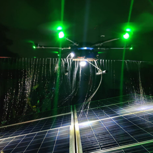
Solar Panel Inspection & Cleaning
Garuda Aerospace’s advanced Surya Drone for solar panel cleaning is revolutionizing the industry with its waterless cleaning technique, reducing water usage to just 100 ml compared to traditional methods requiring 4 litres or more. This solar panel cleaning drone is self-flying, making automated solar panel maintenance more accessible and environmentally friendly. Its operation emits fewer pollutants, is cost-effective, requires minimal manpower, and is easily transportable. The drone’s waterless cleaning technique is not only quick and inexpensive but also has a low environmental impact, contributing significantly to enhancing the productivity and feasibility of solar farms, particularly in arid regions where dust accumulation is a major challenge affecting panel efficiency.
Structural Damage Assessment
Our specialized services in structural damage assessment offer affordable rates and detailed reports, aiding factory managers with safety audits. As a Make in India startup focusing on structural inspections, we are present in 26 cities and have been endorsed by the Government’s Invest in India platform, ensuring all necessary permissions and licenses for operations in Indian industries.
Key Advantages:
– Enhances safety by minimizing human injury risks
– Utilizes drones for accessible areas inspection
– Real-time data processing streamlines structural analysis
– Provides quick assessment of structural damage in complex structures
– High-resolution imaging and video capture for detailed component inspections
– Drastically reduces costs associated with structural damage assessment.
Thermography Drone
Thermography drone services offer a valuable tool for monitoring machine conditions through thermal imaging. Cost-effective thermal inspections using drones enable real-time thermal analysis for structural analysis, allowing potential problems and defects within heat spread to be quickly identified. This approach also facilitates inspection work in low-light and low-visibility environments while the building/bridge/factory is still operational.
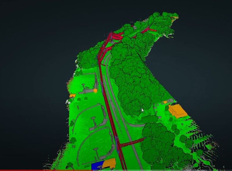
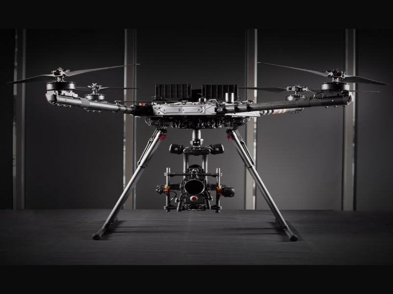
LiDAR Analysis
LiDAR drone technology refers to the utilization of unmanned aerial vehicles (UAVs) equipped with Light Detection and Ranging (LiDAR) sensors for data collection purposes. These drones are designed to carry LiDAR sensors, which emit laser pulses and measure the time it takes for the light to return after hitting objects or surfaces, thereby creating detailed 3D models of the environment. One of the primary advantages of LiDAR drones is their ability to collect high-resolution LiDAR data. This data is incredibly detailed and accurate, making it valuable for various applications across different industries. For example, in forestry, LiDAR data can be used to assess tree density, monitor forest health, and plan timber harvesting operations. In urban planning and construction, LiDAR data helps create detailed terrain models, map infrastructure, and analyze potential construction sites.

Wind Turbine Inspection
Wind turbine inspection drones can significantly decrease efficiency losses and maintenance expenses by providing precise, up-close views of potential defects and quality data, enabling the generation of detailed inspection reports down to the millimeter. Efficient wind farm inspections using drones allow for quick deployment, collecting visual and thermal data within seconds while ensuring technician safety on the ground. Preventative drone inspections for wind turbines offer several advantages such as reducing the risk of human injury, completing inspections swiftly and efficiently, capturing high-resolution images and videos for detailed component analysis, processing real-time data for quick decision-making, and having a lower environmental impact compared to traditional methods involving fuel, noise, and emissions.
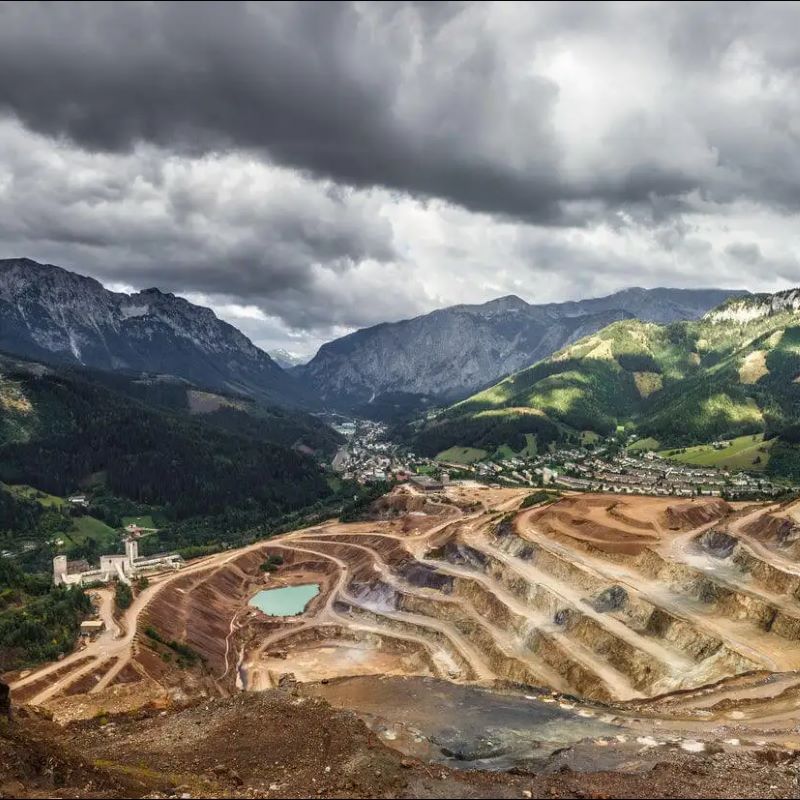
Mining Site Inspection
Mining site drone inspections, powered by drone intelligence and advanced AI software specifically designed for the mining industry, have brought about a transformative impact. These drones, equipped with multisensor payloads and sophisticated software tools, excel in collecting comprehensive aerial data that is crucial for precise mining planning and operations. Their ability to access hard-to-reach areas not only enhances safety but also provides valuable insights for optimizing mining processes. For example, drones can efficiently detect hot spots in coal stockpiles, helping to assess potential spontaneous combustion areas and mitigate risks.
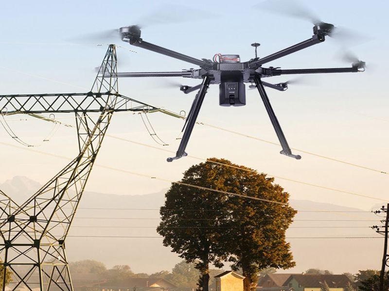
Powerline Inspection & Stringing
Drones specialized for powerline inspection and stringing represent a state-of-the-art solution for the electrical transmission industry. Utilizing unmanned aerial systems (UAVs) significantly decreases the risks to personnel engaged in these activities, making them the safest option for stringing power transmission lines while simultaneously cutting costs, minimizing human hazards, alleviating power cut challenges, and mitigating crop damage in agricultural regions. These drones offer several key advantages, including efficient completion of inspection and stringing tasks, high-resolution imaging and video capture capabilities for detailed assessments, access to challenging or inaccessible areas like rivers or rugged terrains, real-time data processing for swift analysis and decision-making, and reduced environmental impact due to decreased fuel usage, noise, and emissions compared to conventional methods.
Environmental Impact Assessment
Drones play a crucial role in conducting assessments related to climate change impacts, water quality, deforestation, landscape analysis, and habitat assessments. They are unmanned aerial vehicles guided by GPS, capable of flying autonomously through software-controlled flight plans. These drones use various sensors such as cameras, thermometers, humidity and pressure sensors, and wind gauges to collect essential environmental data in areas that are unsafe or difficult for humans to access. By regularly collecting high-resolution images and videos from an aerial perspective, drones facilitate cost-effective data collection and analysis, particularly over large areas and in challenging terrains. They enable real-time data processing, which supports quick analysis and decision-making in environmental monitoring and assessment tasks.