Drone technology is advancing faster in 2026 than at any point in its 100-year history. From AI-powered autonomous navigation and hydrogen fuel cell propulsion to swarm coordination and 5G-integrated real-time data delivery, the capabilities of modern unmanned aerial vehicles are expanding dramatically across every dimension. The global drone market is projected to exceed $101 billion by 2032, and the pace of innovation driving that growth is accelerating. Whether you are a farmer, a logistics company, an infrastructure operator, or an entrepreneur, understanding the latest advances in drone technology is essential to staying competitive in a world where aerial intelligence is becoming a standard operating tool.
What you will learn in this article:
- What the biggest drone technology breakthroughs are in 2026
- How AI, swarm systems, and hydrogen fuel cells are changing UAV capabilities
- Which industries are being most transformed by new drone technology
- How India is positioned in the global drone technology race
- What the next five years of drone innovation will look like
1. What Is Drone Technology and Why Does It Matter in 2026?
Drone technology refers to the full ecosystem of hardware, software, sensors, and communication systems that allow unmanned aerial vehicles to fly, navigate, collect data, and complete tasks autonomously or under remote control.
In 2026, drone technology matters because it is no longer confined to specialist applications. Agricultural operators are using drones for precision crop spraying and crop health monitoring. Construction companies are using them for site surveys. Logistics providers are building delivery networks around them. The common thread across all of these is that drone technology is delivering faster, safer, and more cost-effective outcomes than the methods it replaces.
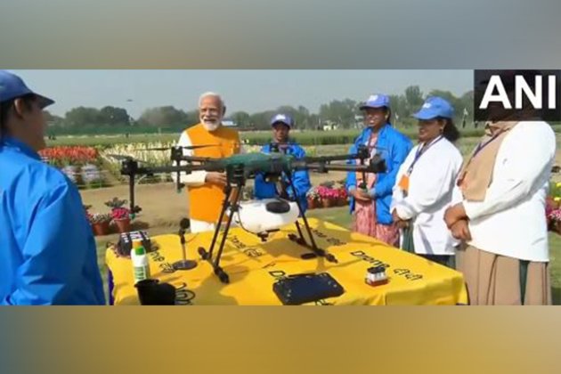
India is a key part of this story. With a CAGR of 20-24% projected for the Indian drone market, government initiatives including the PLI scheme, Drone Rules 2021, and NAMO Drone Didi, and over 38,575 registered drones already in service, the country is building one of the world's most dynamic drone ecosystems.
2. The 7 Biggest Drone Technology Advancements in 2026
2.1. AI-Powered Autonomous Flight
AI-powered autonomy is the single most transformative advancement in drone technology in 2026. Modern drones use machine learning algorithms to navigate complex environments, avoid obstacles in real time, identify targets or anomalies in aerial imagery, and complete entire missions without continuous human input.
Unlike earlier drones that required constant operator attention, today's AI-enabled UAVs can self-correct flight paths, adapt to wind changes, recognise and respond to new obstacles, and even make task-prioritisation decisions mid-flight. Simultaneous Localisation and Mapping (SLAM) technology allows drones to navigate GPS-denied environments -- such as under bridges, inside warehouses, or in dense forest canopy -- using visual cues alone.
This capability is directly improving outcomes in agricultural applications. AI-driven drone platforms can now automatically identify zones requiring treatment during a flight, adjust spray rates dynamically, and generate field health reports without manual data processing after landing.
2.2. Hydrogen Fuel Cell Propulsion
Hydrogen fuel cell technology is solving drone technology's longest-standing limitation: flight time. Standard lithium-polymer batteries give most commercial drones 15 to 30 minutes of flight per charge -- a significant constraint for large-area agricultural operations, long-distance delivery, and extended infrastructure inspection missions.
Hydrogen fuel cells generate electricity through a chemical reaction between hydrogen and oxygen, emitting only water as a byproduct. Drones equipped with hydrogen fuel cells can fly for 2 to 4 hours on a single fuel load, cover dramatically larger areas between refuelling stops, and operate with near-silent performance. For agricultural operators running soil mapping and nutrient analysis missions across thousands of hectares, this extension of operational range changes what is practically achievable in a single working day.
2.3. 5G Integration and Real-Time Data Delivery
5G connectivity is enabling a new generation of drone technology applications that were impossible with earlier network infrastructure. Drones equipped with 5G data links can transmit high-resolution video, LiDAR point clouds, and multispectral imagery to ground stations and cloud platforms in real time -- eliminating the processing delays that previously made drone data useful only after post-flight analysis.
For precision agriculture, this means a farmer can receive a live NDVI crop health map while the drone is still completing its survey flight -- and dispatch a spraying drone to treat a problem zone before the monitoring drone has even landed. For infrastructure operators, it means real-time defect alerts during inspection flights rather than waiting hours for processed reports.
2.4. Swarm Technology and Multi-Drone Coordination
Swarm drone technology allows multiple UAVs to operate as a coordinated fleet, completing tasks in parallel that would take a single drone many hours or even days. Individual drones in a swarm communicate with each other and a central ground control system, dividing mission areas, avoiding mid-air conflicts, and dynamically redistributing tasks if one unit experiences a technical issue.
In agriculture, swarms are enabling coverage rates that match or exceed manned aerial spraying operations -- with the precision and targeting capability that only drone technology can deliver. In entertainment, swarms of 1,000 to 7,000 drones are creating spectacular aerial light shows. In defence and surveillance, swarm tactics are reshaping how military forces approach reconnaissance and strike coordination.
2.5. Advanced Sensor Integration
Modern drone technology platforms are moving beyond single-sensor designs toward multi-payload configurations that collect several types of data simultaneously. A single flight can now capture RGB imagery, multispectral data, thermal readings, and LiDAR point clouds at the same time -- dramatically increasing the data value of each mission.
For agriculture, this means a single drone pass over a field can generate disease and pest detection maps, irrigation stress indices, soil variability data, and canopy height models simultaneously. For construction, the same flight can produce both a photogrammetric 3D model and a thermal scan of roof and wall insulation. The shift from single-purpose to multi-sensor drone platforms is one of the most significant efficiency gains in the industry in 2026.
2.6. Variable Rate Spraying and Adaptive Application
Variable Rate Spraying (VRS) is one of the most impactful recent advances in agricultural drone technology specifically. VRS-enabled drones dynamically adjust spray rates across a field based on pre-loaded prescription maps generated from soil data, NDVI analysis, and historical yield records.
Rather than applying a uniform dose of pesticide or fertilizer across the entire field, a VRS-equipped drone delivers exactly the right amount at each location -- increasing where needed, reducing or skipping where crops are healthy. This precision directly reduces input costs, minimises environmental impact, and improves yield uniformity. When combined with seed spreading capabilities and real-time soil monitoring, VRS represents a genuine step change in precision agriculture efficiency.
2.7. Urban Air Mobility and Cargo Drones
Drone technology is extending beyond survey and agricultural applications into urban logistics and transportation. Cargo drones capable of carrying payloads of 5 to 500 kilograms are entering commercial service for last-mile delivery in urban areas, medical supply chains in remote regions, and industrial component transport between facilities.
In India, drone-based medical delivery projects in Telangana and Arunachal Pradesh have already demonstrated the viability of cargo drone logistics at scale. The regulatory framework for cargo drone operations is developing in parallel with the technology, with BVLOS (Beyond Visual Line of Sight) approvals expanding as safety records accumulate.
3. How Drone Technology Is Transforming Key Industries
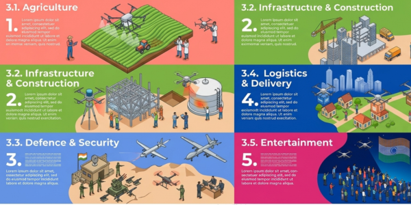
3.1. Agriculture
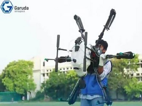
Agriculture is the sector where drone technology is having the most immediate and measurable impact in India. Precision spraying, crop health monitoring, disease detection, soil mapping, and seed spreading are all now commercially available as drone-as-a-service offerings. Explore the full range of precision agriculture drone services to understand how this technology is being deployed at scale across India's farming regions.
3.2. Infrastructure and Construction
Drone technology has cut survey time and costs by 40 to 60% compared to traditional methods in construction and infrastructure management. LiDAR-equipped drones produce centimetre-accurate terrain models in hours rather than days, and thermal inspection drones identify structural defects, insulation failures, and electrical hotspots in assets that would be dangerous or impractical to inspect manually.
3.3. Defence and Security
India's defence establishment is integrating drone technology into battlefield ISR, border surveillance, and counter-drone operations. The May 2025 India-Pakistan conflict demonstrated the strategic value of UAVs for coercive signalling, air defence probing, and precision targeting -- accelerating domestic drone manufacturing investment and doctrinal development simultaneously.
3.4. Logistics and Delivery
Last-mile drone delivery is transitioning from pilot projects to structured commercial operations in India. Companies serving remote healthcare facilities, quick-commerce platforms in urban centres, and agricultural input distributors in rural areas are all actively scaling drone delivery operations in 2026.
3.5. Entertainment
Drone light shows are replacing fireworks at major public events, brand launches, sports fixtures, and weddings across India. Swarms of 500 to 7,000 drones are creating custom aerial animations with zero emissions and near-silent operation -- a combination of creative flexibility and environmental responsibility that fireworks cannot match.
4. How India Is Positioned in the Global Drone Technology Race
India is positioned as a Tier 2 global drone power in 2026, with ambitions to move into the top tier by 2030. The country has strong regulatory infrastructure through the Drone Rules 2021 and Digital Sky Platform, growing manufacturing capability backed by the PLI scheme, and a large addressable market across agriculture, infrastructure, defence, and logistics.
The gaps that remain are in indigenous high-end manufacturing (particularly for MALE-class defence platforms and advanced sensor payloads), BVLOS regulatory frameworks for commercial operations, and deep-tech talent pipelines for AI and autonomy engineering. Government initiatives are addressing each of these, and several India-based startups are now exporting drone components and services globally.
For individual professionals looking to enter this sector, DGCA-approved drone pilot training is the established entry pathway -- providing the certification, practical skills, and regulatory knowledge needed to operate commercially in India's growing drone economy.
5. What Drone Technology Will Look Like in 2030
The trajectory of drone technology points toward several defining developments over the next four years.
Step 1 -- Full BVLOS normalisation. Regulatory frameworks for routine BVLOS operations will be established across major markets, enabling long-distance delivery, national-scale agricultural surveys, and persistent infrastructure monitoring without operator-intensive visual oversight.
Step 2 -- AI-native autonomous platforms. Drones will transition from AI-assisted to AI-native design -- built from the ground up for autonomous operation rather than retrofitted with autonomy features. Human roles will shift from piloting to mission planning and exception management.
Step 3 -- Hydrogen fuel cell mainstream adoption. As hydrogen infrastructure scales and fuel cell costs decline, 2 to 4 hour flight times will become standard for commercial agricultural and logistics drones, displacing battery-only platforms in high-utilisation applications.
Step 4 -- Swarm operations at scale. Multi-drone coordination will become a standard operational model across agriculture, infrastructure inspection, and logistics -- with individual operators managing fleets of 10 to 100 drones simultaneously through AI-assisted ground control platforms.
Step 5 -- Digital twin integration. Drone survey data will flow directly into live digital twin models of farms, construction sites, cities, and industrial facilities -- enabling continuous, data-driven management rather than periodic snapshot-based assessments.
Final Thoughts
Drone technology in 2026 is not a future promise -- it is a present commercial reality delivering measurable value across agriculture, infrastructure, defence, logistics, and entertainment. The organisations and individuals who invest in understanding, adopting, and building on the latest drone technology advances today will be the ones defining industry standards tomorrow.
Whether you are exploring precision agriculture drone services, looking to certify as a drone pilot through a DGCA-approved training programme, or evaluating how drone technology can transform your business operations, the right time to act is now.