1. Why Are Drones in Construction Becoming Standard Practice?
Drones in construction are becoming standard practice because they deliver survey-grade geospatial data at a fraction of the cost and time of traditional ground survey methods. A conventional topographic survey of a 50-hectare construction site might require a survey team of 4 to 6 people working for 2 to 3 days. A drone survey of the same site can be completed by a single certified pilot in under 3 hours, with processed deliverables ready within the same day.
The cost savings are equally significant. DaaS providers consistently report that drone surveys deliver 40 to 60% cost reductions compared to traditional survey methods, while producing higher-resolution data across a wider variety of output formats. For large infrastructure projects with extensive survey requirements, this savings compounds significantly across the project lifecycle.
Beyond cost and speed, drones provide access. Construction sites involve dangerous working conditions, difficult terrain, and structures at height that are genuinely hazardous for human inspectors to access directly. Drones eliminate the safety risk while delivering more detailed data than a human inspector carrying a clipboard could practically collect in the same timeframe.
2. The 8 Key Applications of Drones in Construction
2.1. Pre-Construction Topographic Surveys
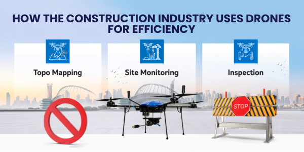
Pre-construction topographic surveys are the most fundamental application of drones in construction. Before any earthmoving begins, project teams need accurate elevation models, drainage analysis, and spatial understanding of the site. Drone surveys using RGB cameras and RTK GPS produce centimetre-accurate digital terrain models (DTMs) and digital surface models (DSMs) that replace conventional total station and level surveys for most commercial applications.
These models feed directly into civil engineering design software, enabling cut-and-fill calculations, drainage planning, and foundation design that are grounded in accurate real-world data rather than less frequent or less detailed ground measurements. For projects on uneven terrain, accurate pre-construction DTMs can prevent costly design errors that only become apparent during earthwork execution.
2.2. Earthwork Volume Calculations
Calculating the volume of earth moved, stockpiled, or remaining in a cut or fill section is one of the most practically valuable applications of drones in construction. LiDAR and photogrammetry-equipped drones generate precise volumetric models of stockpiles and earthwork areas by comparing current surface models against design reference surfaces.
Where traditional volumetric surveys using total stations might be conducted monthly because of the labour involved, drone volumetric surveys can be repeated weekly or even more frequently at minimal marginal cost. This frequency enables construction project managers to track earthwork progress against programme milestones in near-real-time, identifying problems while there is still time to recover them.
2.3. Construction Progress Monitoring
Construction progress monitoring is one of the most widely adopted drone applications across Indian construction sites. Regular drone flights over an active construction site produce consistent, georeferenced aerial imagery that documents exactly what has been built, where, and when. This documentation supports programme management, client reporting, dispute resolution, and quality assurance across the project lifecycle.
Progress imagery captured by drones provides a far more comprehensive and objective record than site photography or progress reports prepared by on-site staff. Time-lapse sequences built from regular drone flights are also increasingly used as marketing and stakeholder communication tools for major projects, creating compelling visual evidence of project advancement.
2.4. 3D Modelling and BIM Integration
Drone-generated 3D models are increasingly being integrated directly into Building Information Modelling (BIM) workflows used for construction project planning and management. Photogrammetry processing converts drone mapping imagery into accurate, georeferenced 3D point clouds and mesh models that can be overlaid against BIM design models.
This clash detection capability is particularly valuable in complex infrastructure projects where multiple construction activities are happening simultaneously across a large site. Identifying a structural element built in the wrong position during construction rather than during a post-construction inspection can save significant rework costs and programme delay.
2.5. Safety Inspections and Hazard Identification
Safety inspections are a critical and growing application of drones in construction. Inspecting scaffolding, formwork, temporary works, and structures at height exposes site safety officers to the same hazards they are assessing. Drone inspections of these elements deliver visual data from positions and angles that would be dangerous or impractical for human inspectors to access.
Beyond routine inspection, drones are used to assess site hazards after weather events, monitor slope stability in excavations and embankments, and document near-miss incidents. The photographic and video record generated by drone inspections is increasingly used in safety management documentation, regulatory compliance, and insurance claim support.
2.6. Thermal Inspections of Structures
Thermal sensor-equipped drones identify heat anomalies in completed structures that indicate insulation defects, moisture ingress, concrete delamination, or electrical installation problems. This application is most valuable during final quality inspections of buildings, roofing systems, and facades, where thermal differentials reveal defects that are invisible to standard cameras.
Thermal drone inspections of building envelopes before handover are becoming standard practice on commercial and premium residential developments in India, providing developers with documented evidence of quality that supports warranty claims and distinguishes their product in a competitive market.
2.7. Asset and Equipment Tracking
Large construction sites involve significant numbers of mobile assets including plant, equipment, materials, and vehicles that need to be tracked for operational efficiency and security. Regular drone flights over a construction site provide a comprehensive overhead view that identifies asset locations, equipment utilisation patterns, and potential security vulnerabilities.
This application is particularly valuable for large linear infrastructure projects such as roads, railways, and pipelines, where assets are dispersed across kilometres of active construction corridor and site management would otherwise require extensive travel to maintain operational oversight.
2.8. Documentation for Dispute Resolution and Legal Compliance
Construction disputes frequently turn on factual questions about what was built, when, and in what condition. Timestamped, georeferenced drone imagery provides objective, comprehensive site documentation that has become increasingly important in contract dispute resolution, insurance claim assessment, and regulatory compliance reporting.
Many Indian infrastructure developers and contractors are now conducting regular drone surveys not just for operational benefit but as a standard risk management measure, ensuring that a comprehensive visual record of site conditions exists for every significant phase of construction.
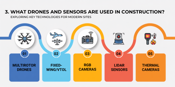
3. What Drones and Sensors Are Used in Construction?
3.1. Multirotor Drones
Multirotor drones, particularly hexacopters and octocopters, are the primary platform for construction drone applications. Their ability to hover precisely, manoeuvre in confined spaces, and operate safely near structures makes them the most versatile choice for the range of tasks construction sites require. Most commercial construction drone operations use multirotor platforms capable of carrying RGB cameras, multispectral sensors, thermal payloads, or LiDAR scanners depending on the specific application.
3.2. Fixed-Wing Drones and VTOL Platforms
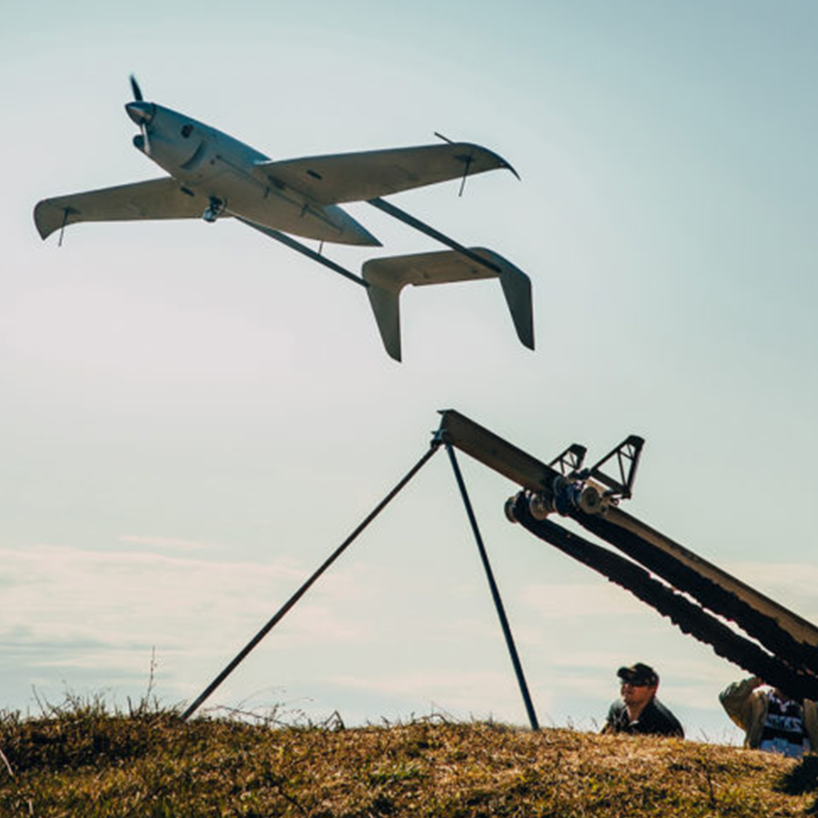
For large-area surveys covering hundreds of hectares, fixed-wing drones and VTOL (Vertical Takeoff and Landing) hybrid platforms offer greater efficiency than multirotors due to their longer flight times and faster coverage speeds. India's major linear infrastructure projects, including highway and railway corridors, routinely use fixed-wing or VTOL platforms for corridor surveys that span tens or hundreds of kilometres.
3.3. RGB Cameras for Progress Monitoring
High-resolution RGB cameras are the primary sensor for progress documentation, 3D modelling, and general site survey. Cameras with RTK GPS integration produce survey-grade orthomosaic maps and 3D point clouds that can be compared directly against BIM models and design drawings. The same technology used for drone mapping and survey work in agricultural contexts applies directly to construction site documentation.
3.4. LiDAR for Precision Terrain Modelling
LiDAR-equipped drones are used where centimetre-accuracy terrain data is required across complex or vegetated terrain. LiDAR penetrates vegetation canopy to map actual ground surfaces and produces denser, more accurate point clouds than photogrammetry in environments where shadow or texture variation limits image-based reconstruction.
3.5. Thermal Cameras for Quality Inspections
Thermal imaging cameras mounted on drones identify temperature anomalies that indicate structural defects, moisture problems, and insulation failures in completed construction elements. The same thermal drone platforms used for disease and pest detection in agriculture apply directly to construction quality inspection.
4. How to Integrate Drones in Construction Projects: Step-by-Step
Successful integration of drones in construction requires a structured approach that aligns drone operations with project management workflows.
Step 1 -- Define survey requirements by project phase. Pre-construction surveys require topographic DTMs and site boundary mapping. Construction phase surveys require progress documentation and volumetric tracking. Post-construction surveys require as-built documentation and quality inspection. Map specific deliverables to each phase before selecting platforms or providers.
Step 2 -- Select the right drone platform and sensor combination. Match platform and sensor selection to application requirements. RGB cameras with RTK GPS for progress monitoring and 3D modelling. LiDAR for precision terrain surveys. Thermal cameras for quality inspections. Consider whether a drone-as-a-service model or in-house capability is more appropriate for your project volume and duration.
Step 3 -- Ensure DGCA compliance. All commercial drone operations in India require DGCA-approved operators holding valid Remote Pilot Certificates and drones registered with Unique Identification Numbers. Construction sites near airports or in yellow airspace zones require additional ATC permission through the Digital Sky Platform. Confirm compliance status before any drone mobilisation to site.
Step 4 -- Establish ground control points for survey-grade accuracy. For construction survey applications where data will feed into design software or BIM models, place surveyed ground control points (GCPs) across the site before each drone flight. GCPs dramatically improve the absolute accuracy of photogrammetric models and ensure data is spatially aligned with existing project coordinate systems.
Step 5 -- Integrate drone data into project management workflows. Drone survey data is only as valuable as its integration into the decision-making processes that drive construction. Connect orthomosaic maps and progress reports directly to project management platforms, BIM systems, and client reporting frameworks. Establish a consistent survey schedule so that data is available at the frequency the project actually needs.
Step 6 -- Train site staff to interpret and use drone outputs. Project managers, site engineers, and quantity surveyors who understand how to read and work with drone survey outputs get significantly more value from the technology than teams who receive data but are not trained to apply it. Brief all relevant stakeholders on the capabilities, limitations, and interpretation of drone deliverables at project inception.
5. What Do Drones in Construction Cost in India?
Drone survey costs in India depend on site area, frequency, deliverable type, and whether you use an in-house drone operator or a drone-as-a-service provider. For small to medium construction sites between 5 and 50 hectares, a single drone survey including data processing typically costs between Rs 20,000 and Rs 80,000 depending on deliverable complexity. For large infrastructure projects, volume-based pricing and survey programme agreements are common.
In-house drone capability requires investment in a certified pilot through a DGCA-approved training programme, survey-grade drone hardware ranging from Rs 3,00,000 to Rs 10,00,000 depending on sensor configuration, and photogrammetry software licences. For projects with regular ongoing survey requirements, in-house capability typically achieves a positive return within 12 to 18 months of deployment.
6. The Future of Drones in Construction
The future of drones in construction is defined by greater automation, tighter BIM integration, and the emergence of AI-driven site monitoring platforms. Real-time drone data feeds directly into digital twin models of active construction sites, enabling project managers to monitor progress against programme on a continuous basis rather than at periodic survey intervals.
Autonomous drone-in-a-box systems that launch, fly, and return without pilot intervention are already being piloted on major construction projects globally and are entering commercial availability in India. These systems enable daily or even hourly automated progress surveys at minimal operational overhead, transforming the frequency and completeness of construction documentation.
The same precision, autonomy, and data quality improvements driving construction drone adoption are also advancing precision agriculture and crop health monitoring applications, reflecting how broadly drone technology innovation across sectors is accelerating simultaneously.
Final Thoughts
Drones in construction are no longer an emerging technology experiment -- they are a proven, commercially deployed capability delivering measurable cost, time, and safety improvements on projects across India. The construction companies and project developers who build drone survey capability into their standard workflows today will carry a significant competitive advantage as project delivery pressures continue to intensify across India's infrastructure development pipeline.
Whether you are a construction professional exploring how to integrate drones into your next project, or a drone operator looking to build a client base in the construction sector, the foundational step is the same: understand the applications, ensure regulatory compliance through a DGCA-certified training programme, and position drone data as a core input into project management decision-making.
Explore how drone-as-a-service solutions and DGCA-certified pilot training are supporting construction projects and infrastructure development across India.