Ignoring the Power of a Drone for Business Could Be the Biggest Mistake You’re Making in 2025
Whether you’re running a farm, managing real estate, conducting environmental research, or keeping an eye on site security, adopting a drone for business can completely change the way you operate. With Garuda Aerospace’s innovative drones like the Kisan Drone and Droni Drone, the sky isn’t just a limit.
Stick with us—this blog will guide you on how drones can enhance your operations, save you time and money, and help you make better decisions for your business.
How to Start a Drone-Based Business in India
Step 1: Get Certified as a Drone Pilot
If you're looking to kickstart a rewarding career in the drone industry, your first move should be to obtain a Remote Pilot Certificate (RPC) from the Directorate General of Civil Aviation (DGCA). This certification is essential for anyone planning to operate drones commercially in India.
Garuda Aerospace, a DGCA-certified training organization, offers RPC courses that are crafted to give you a thorough grounding in drone operation, regulations, safety measures, airspace knowledge, and hands-on flying experience. With Garuda's expert-led programs, you'll receive both in-depth theoretical lessons and practical instruction, ensuring you're well-prepared to fly safely and professionally.
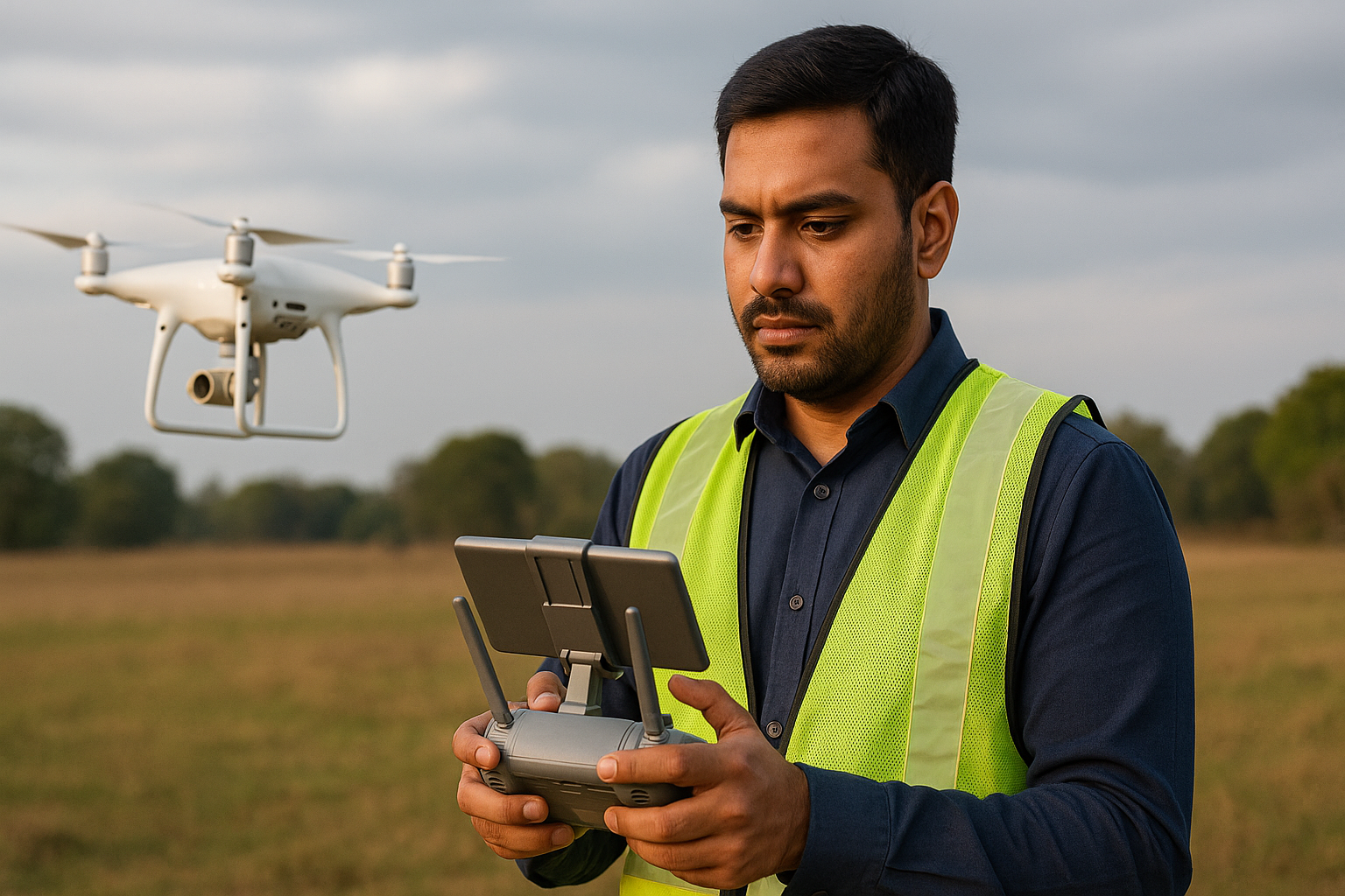
Step 2: Hands-On Training with Industry-Grade Drones
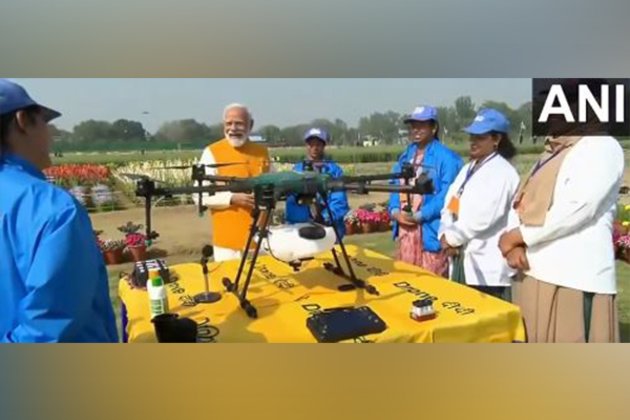
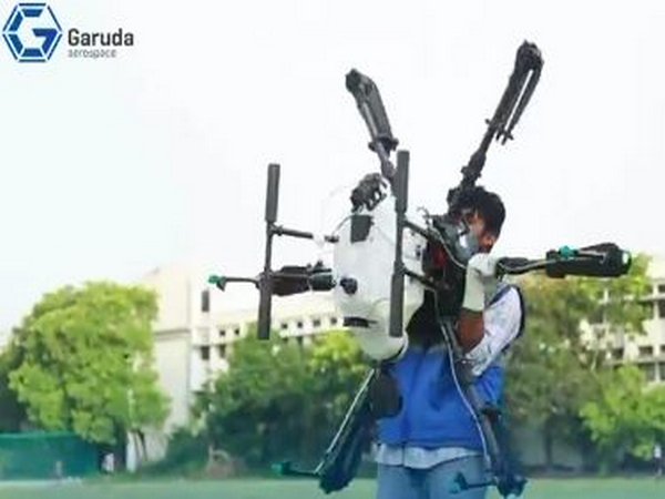
Gaining practical experience is crucial for becoming proficient with drones. Throughout your training, you'll get to fly agriculture-focused drones like the Kisan Drone and visual inspection drones such as the Droni Drone.
The Kisan Drone gives you hands-on experience with precision farming tools, crop spraying techniques, and autonomous flight planning, making it a great fit for those venturing into the agri-tech sector.
On the other hand, the Droni Drone is designed for imaging, inspection, and content creation—ideal for fields like real estate, media, infrastructure monitoring, and environmental research.
This practical training ensures that once you’re certified, you’re not just a licensed pilot—you’re ready for the job market, equipped with the skills and confidence to handle real operational tasks right from the start.
Step 3: Define Your Business Scope & Services
After you’ve earned your certification, the next important step is to figure out how you want to use your drone skills in a professional setting. Drones are incredibly versatile tools, and their applications span a wide range of industries.
Key Sectors Where Drones Stand Out—and How You Can Use Garuda’s Drones for Business:
Agriculture:
Farmers and agri-service providers can take advantage of Garuda’s Kisan Drone for precision spraying, monitoring crop health with multispectral sensors, and analyzing soil erosion. These features not only boost yields but also help cut down on input costs and lessen environmental impact, making it a smart choice for today’s agri-businesses.
Real Estate / Events:
Whether you’re a realtor or a wedding filmmaker, Garuda’s Droni Drone provides professional-grade aerial visuals that enhance property listings, event coverage, and marketing materials. With its high-resolution camera and stable flight, it’s perfect for achieving cinematic results.
Environmental Agencies:
NGOs, forest departments, and environmental consultancies can make use of Garuda’s drones for mapping forest cover, tracking wildlife movements, monitoring water bodies, and documenting ecological changes over time. The real-time data helps speed up decision-making and impact assessments.
Energy & Infrastructure:
Industrial companies can benefit from Garuda’s inspection drones to keep an eye on solar farms, pipelines, transmission lines, and construction sites. These drones cut down on manual inspection time, reduce operational risks, and gather high-quality data using thermal and visual sensors.
Security & Surveillance:
Garuda’s surveillance drones are perfect for crowd monitoring, perimeter security, border patrols, and emergency response. With live HD feeds and automated flight paths, these drones provide quick area coverage and real-time situational awareness for security teams.
Implementing Drone in Your Business Model
Match the Drone to Your Task
Kisan Drone (8L / 10L payload) addresses spraying, mapping, and terrain sensing.
Droni Drone (1080p, 30-min endurance, 2–5 km range) excels in photography, group monitoring, or inspections.
Build Service Packages
Offer tiered services like:
Crop Health Bundle: Drone survey + multispectral report + spraying value.
Visual Storytelling: Aerial video for realtors or event managers.
Eco Audit: Forest scan + soil erosion map + habitat notes.
Side-by-Side Integration
Enhance existing workflows e.g. farmers get faster soil maps; building supervisors get instant site updates; forest guards receive early deforestation alerts.
Client Education & Communication
Highlight benefits like labor savings, faster data, precision. Garuda’s successful use cases help build credibility.
Leading Drone Services That Are Changing Businesses
1. Agricultural Drone Services
Agriculture is one of the sectors where drone technology is making a transformative impact. By automating key tasks and delivering data-driven insights, drones help modernize farming practices, especially in large-scale or remote agricultural operations.
Crop Spraying:
Agricultural drones like the Kisan Drone are designed to spray fertilizers, pesticides, and herbicides with precision. They follow GPS-based flight paths and use automated spraying systems to apply chemicals uniformly across fields. This reduces waste, ensures even coverage, and minimizes human exposure to harmful substances.
Crop Health Monitoring:
Multispectral imaging sensors mounted on drones allow for advanced crop health assessments. These sensors detect variations in plant health by capturing data beyond the visible spectrum. Farmers can identify areas affected by pests, diseases, or nutrient deficiencies much earlier than through visual inspection, enabling timely interventions.
2. Mapping & Surveying Services
Mapping and surveying are essential for urban planning, construction, and infrastructure development. Drones equipped with GPS and photogrammetry technology are changing the game for civil contractors, land surveyors, and developers.
Asset Planning & Infrastructure Analysis:
Developers use drone-generated data to locate utility lines, analyze road access, and assess environmental constraints. This information streamlines planning and reduces costly on-site rework.
Fast Turnaround & High Accuracy:
Drones like the Kisan and Droni models offer centimetre-level accuracy and complete mapping jobs in a matter of hours. This efficiency translates to faster project approvals and higher client satisfaction.
3. Event & Real Estate Photography
Drones add a dynamic and engaging perspective to visual content, making them an essential tool in the media, events, and real estate industries.
Weddings & Event Coverage:
From destination weddings to large public gatherings, drones provide breathtaking overhead shots that are otherwise impossible with traditional cameras. Aerial footage adds cinematic flair and captures the scale and emotion of the event.
Professional Imaging Capability:
The Droni Drone, with its stabilized 1080p video camera and long flight endurance, ensures smooth, high-quality visuals that are ideal for promotional videos, virtual tours, and digital marketing campaigns.
4. Environmental & Utility Inspection Services
Drones are revolutionizing how environmental data is collected and how infrastructure is inspected—bringing speed, safety, and cost-effectiveness to the forefront.
Environmental Monitoring:
Government agencies, NGOs, and researchers use drones to monitor deforestation, track wildlife movement, assess river health, and detect illegal land use. Aerial surveys allow for broader coverage and more frequent monitoring than traditional fieldwork.
Utility Inspections:
Power and energy companies deploy drones to inspect hard-to-reach or hazardous assets like solar panels, wind turbines, pipelines, and power lines. This reduces the need for risky manual inspections and minimizes equipment downtime.
By integrating drones into these sectors, businesses and organizations not only enhance efficiency and safety but also gain access to insights that were previously difficult or expensive to obtain. Whether it’s agriculture, infrastructure, events, or environmental protection, drones are emerging as essential tools for smarter operations.
Key Factors Influencing Drone Usage in Your Business
Drone Capability
Kisan Drone: 8–10 kg payload, 2 MP camera, spray nozzles at 15–20 microns, 7-10 mins flight, working radius of 500–1500 m.
Droni Drone: Compact and foldable, 1080p, 30 min endurance, 2–5 km range, HD stabilized imaging.
Pilot Training & Certification
RPC courses include live-flight lessons, data analysis, DGCA regulations—ensuring you operate legally and effectively.
Market & Client Network
Position your services via agriculture channels, developer groups, real estate networks, and environmental bodies. Garuda’s ecosystem helps connect you to potential partners.
Branding & Service Quality
As competition grows, brand trust becomes crucial. Certificates, clear reports, regular support, and compliance are what clients expect.
Economic Efficiency
Drones reduce overhead—no tractors, fewer field assistants, faster job cycles. Return on investment can be achieved in a few weeks for agri-spraying or mapping clients.
Unlocking Drone Potential: Key Commercial Applications
Environmental Monitoring
Drones For Environmental Monitoring are revolutionizing the way we approach environmental conservation and resource management. With their ability to gather real-time data and capture stunning high-resolution images, they empower stakeholders to spot ecological changes early and take action before issues escalate.
Soil Erosion Tracking:
These flying machines can cover large agricultural fields or forests, making it easy to spot the first signs of soil erosion.
Take the Kisan Drone, for instance—it's specifically designed for farmland and excels at capturing the lay of the land, helping to pinpoint areas that might be at risk of erosion.
Then there's the Droni Drone, which boasts stabilized visuals and a broader range, making it perfect for scanning hilly landscapes and forest slopes. It provides vital information that environmental agencies can use to protect our natural resources.
Monitoring Water Bodies:
Drones play a crucial role in monitoring changes in surface water levels. They can identify drying ponds, dwindling streams, or even the encroachment of wetlands. This information is invaluable for early intervention in water conservation efforts and flood management.
Proactive Mitigation:
By offering early warning signs, drones enable organizations to act before disasters strike. Catching issues like erosion, water stress, or deforestation in their infancy can lead to lower recovery costs and promote more sustainable land use practices.
Security & Surveillance
Drones are becoming essential tools in modern surveillance systems, offering continuous, real-time monitoring of sensitive or high-risk areas.
Border & Perimeter Surveillance:
Security teams use drones to monitor long border stretches, warehouse zones, industrial perimeters, or public gatherings—without needing large ground forces.
Real-Time Coverage with Droni Drone:
The Droni Drone, with its 12 m/s flight speed and 2–5 km range, is capable of rapid deployment. Its HD camera delivers live aerial feeds, allowing security personnel to detect movement, track intrusions, or respond to threats in real time.
Infrastructure Inspection & Monitoring
Inspection tasks that once required manual labor, ladders, scaffolding, or hazardous climbs are now being performed more safely and efficiently by drones.
Applications:
Drones are widely used for inspecting:
Solar farms (panel alignment and damage)
Pipelines (leak detection and surface monitoring)
Flood-prone zones (topography and water flow)
Telecom towers and rooftops (structural integrity)
Enhanced Safety and Speed:
With drone inspections, there’s no need to send workers into risky or hard-to-reach locations. Instead, aerial cameras capture detailed visuals from multiple angles.
The Risks of Ignoring Drone Technology
Many businesses still rely on manual methods that are not only time-consuming but also inefficient. These outdated practices lead to a significant loss of productive hours, especially in sectors like agriculture, infrastructure, and environmental monitoring. Without the precision and speed that drones offer, operations take longer, require more labor, and often suffer from inaccuracies—leading to unnecessary input waste such as water, fertilizers, and chemicals. This not only inflates operational costs but also reduces overall effectiveness.
Meanwhile, competitors using drone technology are gaining a clear edge. Drones enable faster data collection, more accurate execution, and smarter decision-making—all at a lower cost. Companies that delay adoption risk falling behind. Beyond cost and efficiency, the environmental impact of ignoring aerial monitoring is significant. Issues like soil erosion, deforestation, and flood risk often go unnoticed until it's too late.
Additionally, with governments increasingly supporting drone-based agritech through subsidies and compliance incentives, businesses that fail to adapt may also miss out on crucial regulatory benefits and financial support.
The Sky Is Just the Beginning: Final Thoughts
Implementing a drone for business is about enhancing and future-proofing the work you already do. Whether it's streamlining crop spraying in agriculture, capturing dynamic visuals in real estate, or conducting efficient inspections in infrastructure and environmental projects, integrating drones into your operations unlocks smarter, faster, and more precise results.
With advanced drone technology like Garuda Aerospace , businesses across sectors can boost productivity, reduce manual effort, and gain real-time insights that lead to better decisions. Now is the time to elevate how your business works, by bringing the power of drones into your day-to-day operations.