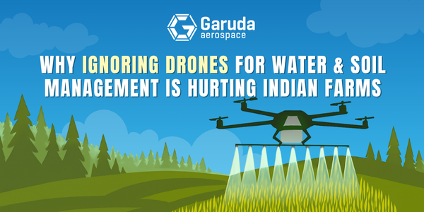
Why Ignoring Drones for Water & Soil Management Is Hurting Indian Farms
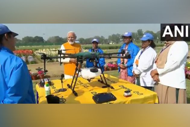
In recent years, drones for water and soil management have emerged as one of the most powerful tools in modern agriculture. These unmanned aerial vehicles (UAVs) are no longer futuristic gadgets; they are becoming everyday assets for progressive Indian farmers. By offering real-time aerial views, precise mapping, and data-driven decision-making, drones are helping resolve long-standing problems in irrigation, soil erosion, and land degradation. Ignoring this game-changing technology could result in greater losses, inefficiencies, and missed opportunities especially when government subsidies and advanced Indian-made models like Garuda’s Kisan Drone are readily available.
Let’s see why ignoring drones is hurting Indian farms. Less care for soil and water means more problems for crops.
Drone-Based Soil Water Erosion Monitoring: Problem with Traditional Method
Soil erosion caused by water runoff is a quiet yet serious issue in Indian agriculture. Factors like heavy rainfall, deforestation, and poor land management are leading to the loss of precious topsoil, which in turn diminishes crop yields and affects long-term farm productivity.
Traditional methods of monitoring the ground can be slow, inconsistent, and often overlook the full extent of the damage.Implement Drones, which can capture high-resolution aerial images in just minutes, allowing us to pinpoint areas at risk of erosion before the damage escalates.
Garuda Aerospace’s Kisan Drone, fitted with multispectral and thermal sensors, can fly over farmland to monitor surface runoff, catchment areas, and soil movement in real time. This valuable information empowers farmers to construct check dams, contour bunds, and water-retaining structures exactly where they’re needed, maximizing their returns with minimal effort.
Garuda’s Drones: Watching Over Soil Erosion
The real power of drones comes from their ability to conduct aerial surveys using advanced technologies like thermal imaging, and sensors. These tools can accurately measure changes in the landscape, soil moisture levels, and the health of vegetation. Unlike traditional field inspections, which can be prone to human mistakes, drones provide consistent results across various areas and times.
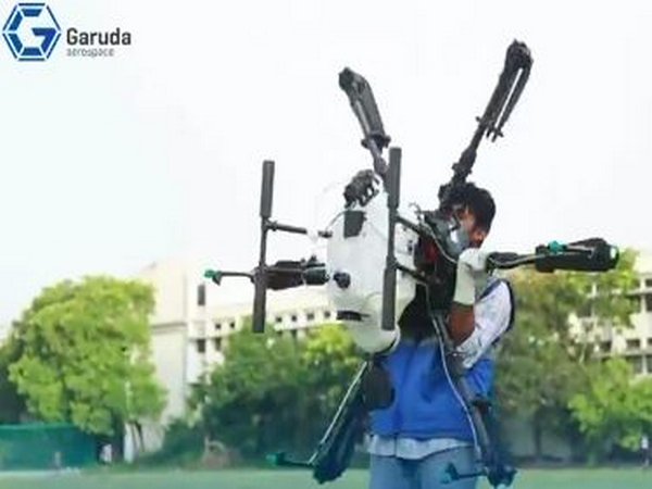
For example, take the Droni Drone from Garuda Aerospace. This advanced Indian UAV offers precise tracking of environmental factors and boasts a range of up to 5 km, along with 1080p HD video streaming. It's not just useful for agriculture; it’s also great for mapping and conducting remote environmental assessments. The data collected is crucial for both immediate irrigation strategies and long-term conservation efforts.
Drone Application in Different Areas of Soil Erosion
Gully Erosion
Gully erosion creates deep channels that cut through fields, making land unusable and dangerous. Kisan Drones are capable of identifying early gully formations. Farmers can use this information to install preventive structures or redirect water flow before the gully deepens.
Landslide Erosion
In hilly regions, landslide erosion is a frequent hazard. UAVs offer quick post-landslide surveys, helping authorities and landowners understand how much soil has been displaced and where stabilization is needed. This timely data prevents further slippage and supports reforestation or terracing efforts.
Can Drones Guide Smarter Farming in a Changing Climate

Yes and not just marginally. With unpredictable climate conditions, managing water and soil efficiently is no longer a choice but a necessity. Drones allow farmers to plan irrigation schedules based on actual need, rather than guesswork. They help detect over-irrigated or water-deficient zones and monitor the changing patterns of seasonal rainfall and soil saturation. These insights are especially critical as climate change continues to destabilize rainfall and temperature patterns.
By enrolling in Garuda Aerospace’s certified drone pilot training, farmers and agri-tech workers can learn to operate drones safely and legally. Becoming a certified drone operator means having the power to conduct on-ground assessments, monitor crop health, and contribute to environmental conservation
Drone-Based Remote Sensing
Remote sensing via drones helps generate actionable data on soil type, water content, and crop stress levels. Unlike satellite imagery, drones can operate even under cloud cover, offering more accurate and timely data. This empowers Indian farmers to adopt precision farming methods, saving inputs like water, fertilizer, and pesticides while maximizing yield.
How Garuda’s Drones Are Helping to Grow the Agricultural Industry with Advanced Soil Analysis
Soil is the foundation of farming. Poor soil leads to poor yields. With drones, farmers no longer need to rely on assumptions or trial-and-error. They receive detailed analysis of how different parts of their fields are performing, and can apply resources accordingly. This shift toward data-driven farming marks a major step forward for India’s food security.
Enhanced Efficiency, Cost Reduction, and Improved Accuracy
Using drones reduces the need for repetitive, manual labor, thus saving time and money. With fewer resources, farmers can achieve better results. Drones also improve precision, reducing water waste, pesticide use, and unproductive interventions. The Kisan Drone can spray over 30–35 acres a day, and with terrain sensing and obstacle detection features, ensures efficient and safe operations.
(a line or 2 about droni’s features)
Data-Driven Decision Making
The most valuable feature of UAVs is the data they generate. With Garuda’s Drone, farmers can interpret this data to understand which fields need more water, which need drainage, and where soil health is declining. These data insights form the core of modern precision agriculture.
Drones for Water Resource Management and Monitoring

Drones are instrumental in managing and protecting water sources. They are used for:
Inspection: Identifying water pipe leaks or canal breaches.
Surveying: Mapping aquifers, reservoirs, and irrigation zones.
Water Sampling: Collecting water samples from inaccessible locations.
Asset Management: Monitoring wells, tanks, and irrigation lines.
Water Resource Management: Optimizing water usage based on crop requirement and field condition.
The Role of Garuda’s Drone in Forest Management
Even forest ecosystems benefit from drone surveillance. Drones can help spot illegal encroachments, water logging, and deforestation early. This ties directly into water management, as healthy forests regulate water cycles and prevent erosion.
Using the Droni Drone or Kisan Drone, forest officials can map large areas quickly and monitor for signs of soil degradation, waterlogging, or fire-prone zones. Real-time drone footage helps in maintaining a healthier, more balanced ecosystem.
Why Farmers Should Not Ignore Drone Technology for Water and Soil Management
Farmers who overlook the advantages of using drones for managing water and soil are putting themselves at a disadvantage when it comes to productivity, sustainability, and profitability. With the unpredictability of weather, increasing input costs, and tightening profit margins, traditional farming methods just can’t keep pace.
Garuda Aerospace’s drones, like the Kisan Drone and Droni Drone, provide affordable, scalable, and government-backed solutions to tackle these challenges.
By becoming certified drone operators, farmers can take charge of their agricultural planning, tap into subsidies, and join the next wave of agricultural innovation. Ignoring the potential of drones isn’t just a missed chance; it’s a significant setback for the future of farming in India.